AR
Size: a a a
2020 October 05
Києва на них поки не знайшов
AR
і Тартарією Русь НІКОЛИ не називали
AR
Тартарія була значно східніше
I
Помоему разговор идет к тому, что мы олд_нейм из Crusader Kings III брать начнем. Вс...лся же этот староитальянский. Я более чем уверен, что им сейчас никто не пользуется и ж тем более он нафиг не нужен в Украине.
A#
Olha Mur
ця назва маэ бути обоязково iwowik просив прибрати дублювання тому що було уведено двічі
Пздц. Чего ты такой упертый и не пробивной?
😐
ID
Помоему разговор идет к тому, что мы олд_нейм из Crusader Kings III брать начнем. Вс...лся же этот староитальянский. Я более чем уверен, что им сейчас никто не пользуется и ж тем более он нафиг не нужен в Украине.
так-то не нам решать, какой язык нужен, если это можно сделать, кому это мешает?
😐
а шо там с Румунами? они реально по дефолту все залили полями?
I
так-то не нам решать, какой язык нужен, если это можно сделать, кому это мешает?
Ок-ок.
I
а шо там с Румунами? они реально по дефолту все залили полями?
А ты сам глянь на карту.
Вот пояснения - https://wiki.openstreetmap.org/wiki/Proposed_features/Romania_CLC_Import
Вот пояснения - https://wiki.openstreetmap.org/wiki/Proposed_features/Romania_CLC_Import
😐

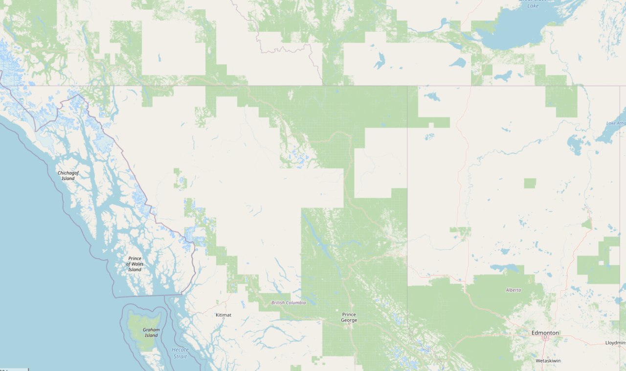
мне интерсна судьба этого проекта, импорт лесов Канады,
😐
ID
А ты сам глянь на карту.
Вот пояснения - https://wiki.openstreetmap.org/wiki/Proposed_features/Romania_CLC_Import
Вот пояснения - https://wiki.openstreetmap.org/wiki/Proposed_features/Romania_CLC_Import
да, вижу
OL
До речі, про імпорт. Вчора знайшов офіційні морські карти США, Гаїті та ще чогось, чим NOAA займається - там векторні карти мало того, що безкоштовні, в них ще й така ліцензія:
The NOAA electronic navigational chart (NOAA ENC®) files that may be downloaded from the National Oceanic and Atmospheric Administration (NOAA) are official products. Official ENCs are suitable for navigation under the following regulations and policies, and in the following circumstances:
...
The NOAA ENC® files available from this site are updated for Notices to Mariners on at least a monthly basis. Users are encouraged to check the site frequently and download the latest versions of the files. Updates are currently available as incremental updates (also called ENC Revision or "ER" files).
Copying, reproduction of the NOAA ENC®s to any other server or location for further reproduction or redistribution is discouraged unless the following guidelines are followed: 1) the NOAA ENC®s and supplementary files including the CATALOG.031 and README.TXT are included in their entirety, 2) this disclaimer is displayed to and accepted by anyone who accesses the NOAA ENC®s, and 3) a reference to this Web site is included so that anyone accessing the NOAA ENC®s is advised of where they originated.
Якщо я правильно розумію, то щонайшенше якщо вказати посилання на NOAA у source, то проблем ніби не повинно бути, бо OSM - це буде вже похідна робота, а не пряме копіювання або редистрибуція.
Хоча я все одно не шарю, як з цих карт робити масовий імпорт)) Та й США мене не дуже цікавить. Але схоже, що це можливо.
D

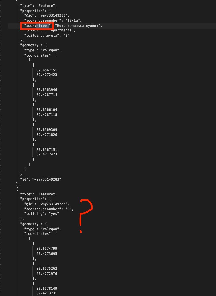
Подскажите пожалуйста, в некоторых рекордах отсутствует
http://overpass-turbo.eu/s/YHx
СС: @ququruzka @alexriabtsev @ndygol Andriy
addr:street, с чем это может быть связано, может быть с тем что нужно добавить associatedStreet?http://overpass-turbo.eu/s/YHx
СС: @ququruzka @alexriabtsev @ndygol Andriy
n

Подскажите пожалуйста, в некоторых рекордах отсутствует
http://overpass-turbo.eu/s/YHx
СС: @ququruzka @alexriabtsev @ndygol Andriy
addr:street, с чем это может быть связано, может быть с тем что нужно добавить associatedStreet?http://overpass-turbo.eu/s/YHx
СС: @ququruzka @alexriabtsev @ndygol Andriy
так, можуть бути такі випадки, коли будинку зазначається лише addr:housenumber, тоді назву вулиці треба брати з батьківського зв'язку
D
так, можуть бути такі випадки, коли будинку зазначається лише addr:housenumber, тоді назву вулиці треба брати з батьківського зв'язку
Буду очень благодарен если подскажите как я могу это сделать!
n
треба дивитись, чи будинок входить до зв'язку associatedStreet з ролю house
D
Спасибо
AP
ID
А ты сам глянь на карту.
Вот пояснения - https://wiki.openstreetmap.org/wiki/Proposed_features/Romania_CLC_Import
Вот пояснения - https://wiki.openstreetmap.org/wiki/Proposed_features/Romania_CLC_Import
То есть такие вещи в большинстве своем делались импортами, а не ручками? А то мне было страшно смотреть на карту в некоторых европейских странах, где около 100% покрытие лендюзами
I
То есть такие вещи в большинстве своем делались импортами, а не ручками? А то мне было страшно смотреть на карту в некоторых европейских странах, где около 100% покрытие лендюзами
Скорее всего.
n
Хто хоче додати лінк на ОСМ до цієї статті у Вікіпедії?
https://uk.wikipedia.org/wiki/Фолксономія
https://uk.wikipedia.org/wiki/Фолксономія


